

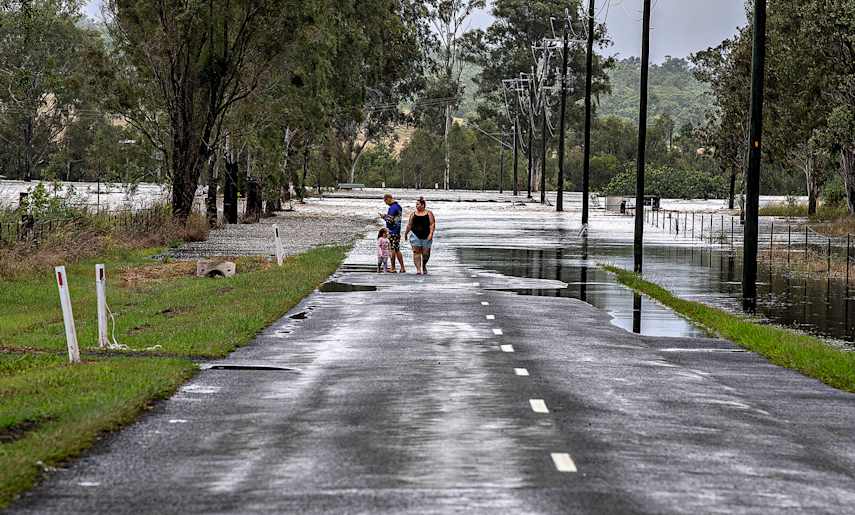
The western end of Railway Street, Rosewood. ‘Prepare to leave’ alerts were sent to residents in the town and surrounding areas at 7.15pm on Monday as authorities believed the Bremer would reach major flood heights. Early morning on the same day, residents in the Calvert, Grandchester and Lanefield areas were also advised of an emergency alert due to rising floodwaters from Western Creek. Photos: LYLE RADFORD
Water pooling in the Rosewood State School grounds.
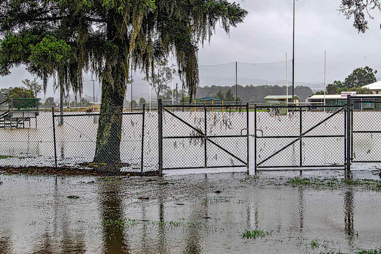
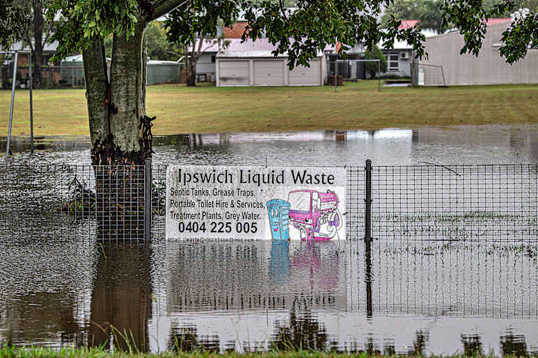
Rosewood Roosters rugby club grounds were submerged from fence to fence on Monday.
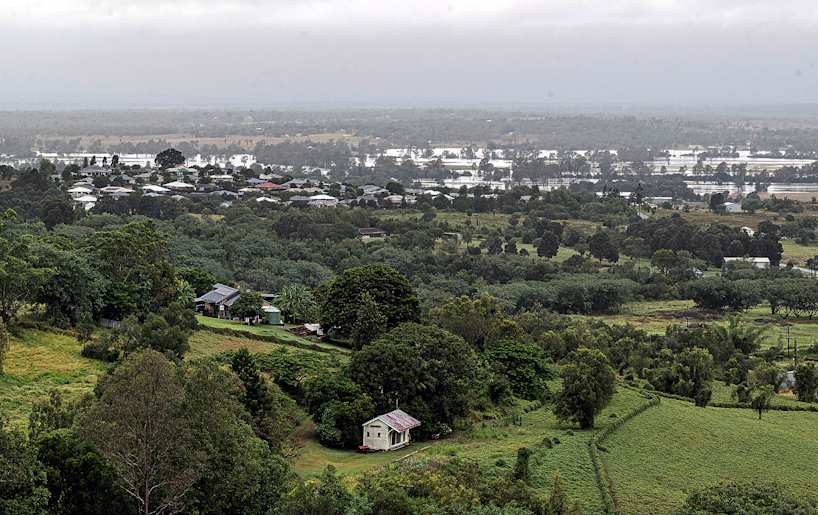
The view across Rosewood from Tallegalla Hill on Monday morning showed the extent of the floodwaters beyond the main built up area.
A sea of water from the Bremer River at Armstrong Park in Rosewood.

Rising flood waters from the Bremer River spread across the background of a property on McGeary’s Road, Rosewood.
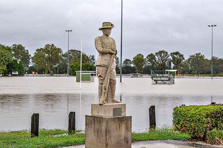
The Rosewood RSL Memorial appears to have a lakeside setting as rising floodwaters from the Bremer completely swamp the Rosewood Roosters rugby club grounds in the background. This is thought to be the first time in more than 50 years, that floodwaters have been so widespread across the flood plain.
THE full impact of Tropical Cyclone Alfred and the subsequent tropical low has yet to be assessed.
Coastlines along the South East Queensland and northern New South Wales regions were devastated. The cost to repair the beaches and the exposed infrastructure from the destructive storm surges, record wave heights and cyclonic winds is already being estimated to be in the billions of dollars.
The main impact in this district was the tropical low that formed from the much weakened cyclone after it lingered over Moreton Island.
A feature of the week from Monday, March 3, were warnings of the likelihood of the cyclone making landfall somewhere along the coast of South East Queensland.
By mid-week, the Bureau of Meteorology was forecasting that it would cross onto the mainland somewhere north of Brisbane. This prediction firmed to the northern suburbs of the CBD as the system slowed and lingered out to sea from the city.
TC Alfred
What began as a tropical low in the Coral Sea on February 20 was upgraded by the Bureau of Meteorology (BoM) as a Category 1 cyclone, two days later.
The slow moving system continued to intensify as it moved down the coast and by February 27 was upgraded to a Category 4 cyclone.
It fluctuated between a Category 3 and 4 until March 1, then weakened to a Category 1. This was followed by the intensity fluctuating between a Category 1 and 2 until just before it made landfall on Moreton Island at 11.30pm on Friday, March 7.
The system weakened to a tropical low before it reached Bribie Island at 8pm on Saturday, March 9 and the mainland around an hour later.
Quiet time
On Saturday (March 8), it seemed to many residents that the downgrading of the cyclone to a tropical low had given much of the region a reprieve despite the regular BoM warnings of the potential for intense rainfall leading to major flooding.
The forecast became the reality.
Intermittent rain fell during Saturday and Sunday, but on Sunday night the rainfall intensity increased and residents awoke to rising floodwaters.
And road closures in all flood prone areas.
At 7.15pm, a ‘prepare to leave’ warning was issued by police and the Ipswich City Council to residents of Rosewood and surrounding districts. It read, in part:
Prepare to leave due to flash flooding. River and creek levels are expected to continue rising, with major flooding expected to extend downstream during Monday and into Tuesday. And an evacuation centre was declared at the Rosewood High School.
It was a ‘watch and act’ level alert and fortunately, flood waters subsided before widespread evacuations were enacted.
The Bureau of Meteorology rainfall station at Franklyn Vale recorded a fall of 292mm (11.5ins) in the 24 hours to 9am on Monday. In the days from Tuesday March 4 to Tuesday, March 11, Franklyn Vale received 379mm (15ins) in total.
The rain station at Tallegalla measured 179mm (7ins) in the 24 hours to 9am on Monday. From Tuesday, March 4 to Tuesday, March 11, Tallegalla received 262mm (10.3ins) in total.
The rain station at Amberley measured 163mm (6.4ins) in the 24 hours to 9am on Monday. From Tuesday, March 4 to Tuesday, March 11, Amberley received 278mm (11ins) in total.


